

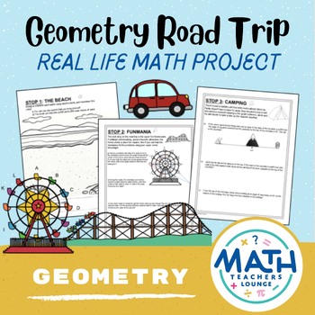
Geometry Road Trip - Project Based Learning PBL
Write a review.

- Create New Wish List
Description
Follow along with Jacob and his family on their summer road trip! This project is a great end-of-the-year activity for your high school geometry students, as it reviews many topics that are taught throughout the year. It can also be broken up into the individuals tasks, to give as an end of unit assessment activity for each topic.
This project is a great follow-up to many topics of geometry, including:
- Volume: Cones, pyramids, and cylinders
- Circles: Central arcs, inscribed angles, and segment lengths
- Trig Ratios: Angles of elevation and depression
- Similarity: Similar triangles and proportional parts
- Quadrilaterals: Properties of parallelograms and coordinate proof
Check out more fun math activities at the Math Teachers Lounge .
Related Products

Summer Road Trip - Real Life Math Project Based Learning PBL

Percentages Project Based Learning Run a Factory Percents PBL Math Enrichment

Surface Area and Volume of Prisms Project Based Learning PBL Math Enrichment

Make a Budget - Real Life Math Project Based Learning PBL

Project Based Learning: Ancient Greece Athens-Sparta PBL
Check Out the New Website Shop!

Novels & Picture Books
Anchor Charts

Math Projects: Differentiated Hands-On Learning
By Mary Montero
Share This Post:
- Facebook Share
- Twitter Share
- Pinterest Share
- Email Share
When I’m looking for rigorous practice that’s so fun the students almost forget they’re learning, I turn to math projects! These projects hold so much learning power with their real-world connections, differentiation options, collaborative learning opportunities, and numerous avenues for cross curricular learning too. PLUS they’re printable and digital for even more flexibility.
I’ll never forget the first math project I made. I was the gifted coordinator and teacher, and we had just finished working on multiplication. My students had a pretty solid conceptual foundation of the skill, but they needed a bit more real-world practice. At the time, my husband worked in hotels, so we sat down together and made my very first math project, The Resort Report. At the time (back in 2012), there was simply NOTHING like this available on TpT, so I had such a great time designing it and determining the best way to make the math project work. Once I implemented the math project into my classroom, there was SO much math skill practice, SO much real-world math relevance, and SO much engagement. My students were literally BEGGING for more. From that point forward, I started creating math projects for every unit we were doing. My students absolutely loved them, and these math projects have become a cornerstone of my teaching.
How To Use Math Projects
- Cumulative review or assessment project for end of unit . Each of my math projects is designed to show mastery of MULTIPLE skills related to the concept at hand. Many eliminate the need for traditional assessments, which is a win-win for both students and teachers.
- As seasonal practice. Upper elementary students love seasonal fun, too. The seasonal math projects are specifically made for this!
- Anytime review . Math projects are perfect at the beginning of the year for brushing up on the previous grade’s skills, during test prep, or at the end of the year when you’re looking for structured fun.
- Math centers . The projects are great for collaborative learning and work so well as ongoing math centers. Sometimes, I will break up the pages and make each page a different center or math station.
- Differentiation . You can pull out and assign specific pages for each student or group. This is such an easy way to differentiate, and students rarely even realize they are working on separate pages. I design almost all of my math projects to have pages that stand alone, so they are easy to pick and choose from.
- Early finisher projects or warmups . Students can keep their current project in a folder for easy access. These are particularly awesome for enrichment as most require some level of higher-order thinking. THESE ARE NOT BASIC WORKSHEETS.
- At-home math homework. Ditch the worksheets and send these math projects home for some at-home practice!
- As the cornerstone to a Project-Based Learning Unit. While I don’t claim that these math projects are PBL (they are missing a few components), they are PERFECT to integrate into our project-based learning units. I have seen teachers do AMAZING things alongside these math projects… students design full hotels including scale models, they created a real classroom movie theatre, etc.
- As the basis for mini room transformations. I simply don’t have the energy for massive room transformations, but these projects all lend themselves SO well to mini-themed room transformations. For example, when we are completing The City of Shapes Perimeter and Area Math Project , I get each student a hard hat from Oriental Trading. For Place Value Detectives , they get their projects in a detective folder. For the Great Zoo Review , they put on a zookeeper visor and earn an animal coin (again from Oriental Trading) as salary for their hard work on each page. The options are limitless, and a little bit goes a LONG way to keep your students engaged. They truly LOVE this little aspect if you are able to work it in.
What Sets These Math Projects Apart?
Every time I set out to create a new math project, I look at the concept we are working on and outline all the different ways that skills needs to be practiced. I consider how I can review the skill and ways that I can encourage students to really stretch their thinking with the concept. It’s incredibly important to me that my math projects aren’t just another worksheet with a pretty theme, and I go to great lengths to create in-depth projects that help students excel. Every single one of my math projects has been designed to enrich and extend student thinking.
More Math Project Ideas
Here’s some feedback from classroom teachers on how they used these math projects.
I love that it’s “real life” math. The students get to use the skills that they’ve learned and apply it to “real life” situations to see that math really is everyone! – Seasonal Bundle
Such a fantastic set of ready-to-go, super engaging projects. My students were so excited to complete these challenging, appropriate, real-world scenarios using both new and old math skills. Students got to use varied strategies to figure out what methods worked best for them, the differentiation was perfect, and they were easy to break down into bigger or smaller chunks depending on the group and level. – Seasonal Bundle
I have used these projects in the classroom as early finisher packets so that students have something to be working on. I have also used them in my remote weeks as lesson follow up. The kids are very engaged and I love that they tie our topics in with the season. – Seasonal Bundle
This is a great, easy to use, resource for my students during our time in distance learning. I love doing STEM activities and can actually create an activity based on each of these Math Projects! I love it! The assessments are amazing! I will continue to use them when we get back in the classroom! – Concept Bundle
These projects are fantastic! I am always looking for ways to make math more hands on for my students and this was exactly what they needed. These activities give my students a purpose for using what they have learned and they are having fun doing it! – Concept Bundle
A Closer Look At A Few Favorites
I use both concept-based math projects to focus on specific standards and seasonal math projects that integrate several skills. Here are some of my favorites!
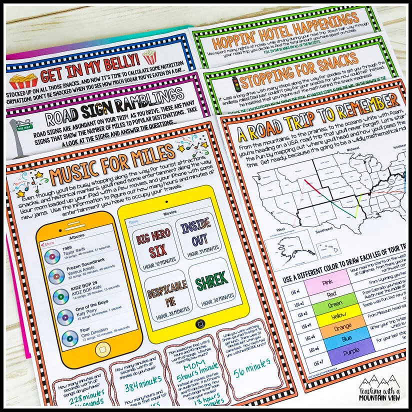
Road Trip Math: I love using this road trip math project at the end of the year or the beginning of the year as we talk about summer break. This one also has FREE road sign math task cards that work well with it. It covers SO MANY math skills like problem solving, place value, money, etc.
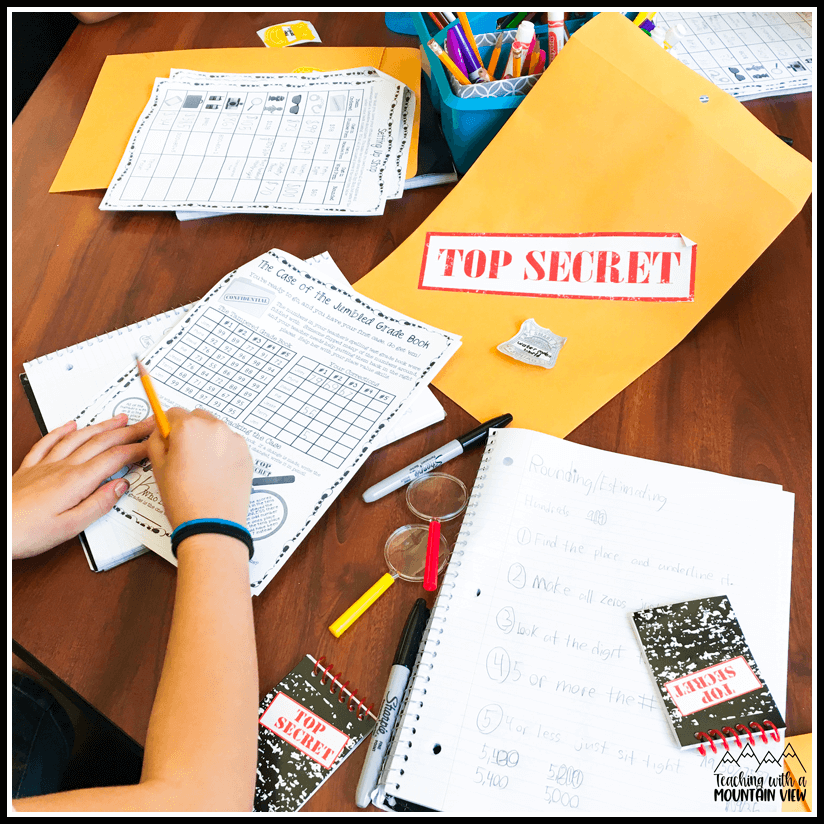
Place Value Detectives: This place value math project is BY far my most-loved math project! Turn your students into crime-fighting detectives while reinforcing place value skills . These are five different crimes to solve and four of the activities have two different options to make differentiating within the same project a snap. If you’re teaching place value, this post is full of more place value ideas .
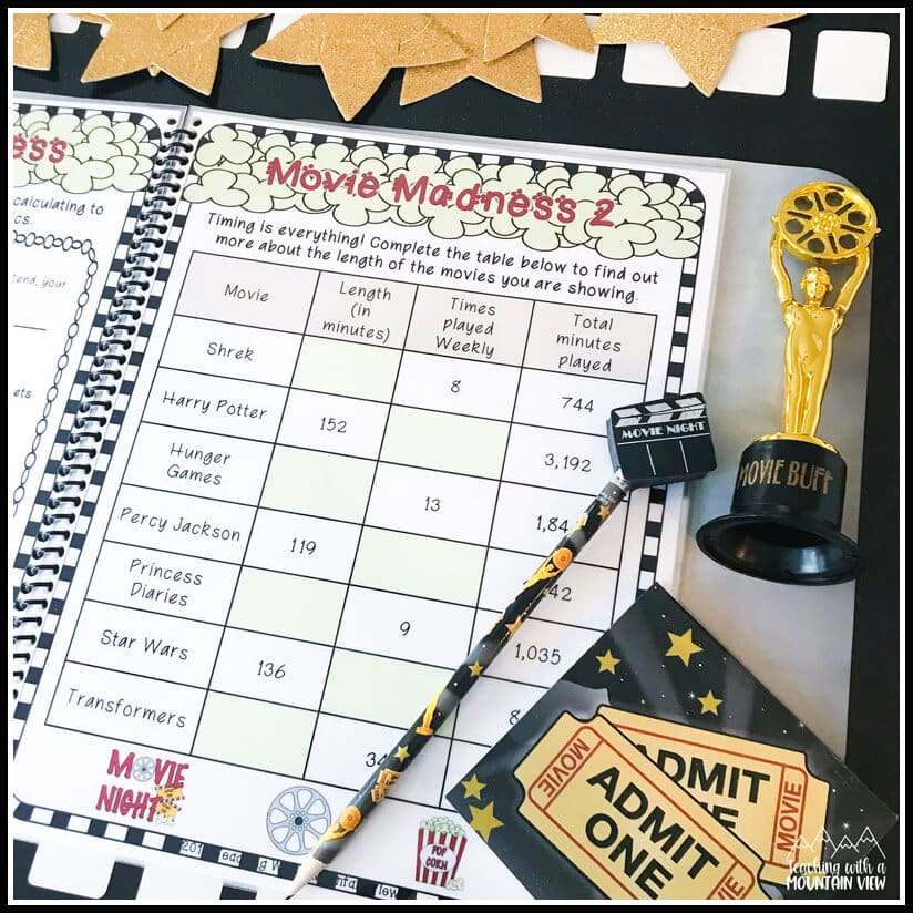
Long Division Movie Marathon: Extend and enrich division skills with this math project while students explore the ins and outs of designing and running their own movie theatre. There are actually two math projects in here, one advanced (two-digit divisors) and one standard (one-digit divisors) so you can use it across multiple levels! See this post for more long division ideas .
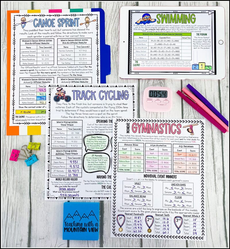
Decimal Place Value Sports Scramble: This one tops my list for most fun to create! Let your students be the judges with this decimal math project ! The biggest sporting championship of the year has just wrapped up and your students have stepped into the role of Scoring Official for the games! I also have this post full of more decimal ideas .
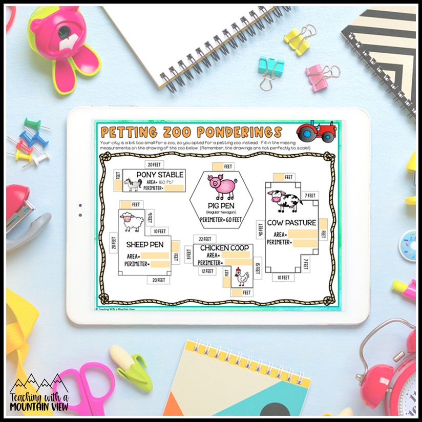
City of Shapes Perimeter and Area Math Project: Students will create and design buildings and other features in their imaginary city. From parks and recreation to housing and hospitals… it’s all up to them to design using their perimeter and area skills . You can get a closer look at this project and more perimeter and area ideas here .
All Current Math Projects
- Concept Math Project Bundle
- Seasonal Math Project Bundle
- Addition and Subtraction Zoo Math Project
- Division Movie Math Project : TWO Differentiated Versions
- Fractions Bakery Math Project
- Place Value Detective Project
- Multiplication Resort Math Project
- Multiplying and Dividing Decimals Shopping Math Project
- Adding and Subtracting Decimals Shopping Math Project
- Graphing and Data Big Top Math Project
- Elapsed Time Detectives Math Project
- Drone Deliveries Coordinate Grid Math Project
- Perimeter and Area City Math Project
- Measurement and Geometry Theme Park Math Project
- Decimal Place Value Sports Project
- Road Trip Math Project
- Halloween Math Project
- Thanksgiving Dinner Math Project
- To Grandmother’s House We Go: Christmas Math Project
- The Winter Wonderland: A Winter Math Project
- Exploring Ireland: Addition and Subtraction Math Project
- The Sum of School: Cumulative Test Prep Project (TWO differentiated versions)
- End of the Year Party Planner Math Project
- For The Love Of Math: A Valentine’s Day Math Project
Reading Projects
If you’re interested in using projects in your literacy instruction too, I also have a reading projects bundle !
Mary Montero
I’m so glad you are here. I’m a current gifted and talented teacher in a small town in Colorado, and I’ve been in education since 2009. My passion (other than my family and cookies) is for making teachers’ lives easier and classrooms more engaging.
You might also like…
Leave a Reply Cancel reply
Your email address will not be published. Required fields are marked *
- Pingback: Practical Classroom Decor Tips - Teaching with a Mountain View
- Pingback: Math Workshop Ideas for Upper Elementary - Teaching with a Mountain View

©2023 Teaching With a Mountain View . All Rights Reserved | Designed by Ashley Hughes
Username or Email Address
Remember Me
Lost your password?
Review Cart
No products in the cart.
National Geographic Education Blog
Bring the spirit of exploration to your classroom.

“A Field Trip Anywhere”: Try This MapMaker Project With Your Students
Educator Tama Nunnelley wrote this post.
If you could take your students on a field trip anywhere, where would you go? What kinds of things would you like them to see or learn on this quest? Maybe you would take them back to a historical time period or specific event so they could see it with their own eyes. Perhaps you would take them to a series of locations where they would interact with historical or current events. Well, you can do just that without ever leaving your classroom. How? With digital maps!
I often take my students to places in their own community, around the globe, or back in time by combining geographic skills with historical study. Geography isn’t just for geographers or geography classes. It plays an important part in each social studies class. Studying geography teaches young people a wide range of useful skills for the workforce, including critical thinking and problem solving. Some of the fastest-growing careers involve the use of geographic skills, including fluency with geographic information systems (GIS) .
One way I transport my students to different locations so they can use their own analytical skills is with National Geographic’s MapMaker . (Note: this project uses MapMaker Classic , which is free to educators alongside the newly revamped MapMaker .) MapMaker is designed for student practice with GIS. It does not require a lot of cartography skills to use and is a perfect tool to do cross-curricular activities and share maps as primary source materials.
To develop the attitudes, skills, and knowledge of a geographer while exploring their own world, each year my students undertake a semester-long project to create a road trip to a select part of the world based on their grade level. The project combines math, English language arts, science, and social studies. Geography and Community subject students are tasked with travel within our state. American History students can travel within the borders of the United States. World History students have the entire globe at their disposal. I have done this project across multiple middle school grades and have adapted it for high schoolers and college first years. I believe it could be easily adjusted to all age ranges.
The first step in this process is to have students select three locations for travel by exploring in MapMaker. After choosing their locations, students plot each one on their digital maps; this involves selecting the pin they want to use for their location and placing it onto the map. They can navigate to their specific location by finding its latitude and longitude (click the bottom icon on the menu on the left-hand side of the screen for these settings) or zooming in or out using the “+” and “-” icons in the top left of the screen. Then, they select their pin of choice from the menu. They can select numbered markers or scroll down the menu for something more fun. Then, they can click on the correct location to add their pin.

Next, students use the mileage tool to see the distance between locations and create a budget for their trip. They are given a certain amount of money based on current prices and plan their travel around that total. They have to account for how many people they take with them and regular travel expenses like airfare, gasoline, hotels, and meals. They might also have to pay a fee to see the historical site on their itinerary. They select methods of travel and keep a spreadsheet of expenses. We use MapMaker to see where these locations are and use the mileage tool to determine distance. Students may adjust locations to better fit their budget after their calculations.

Students are also expected to tell us about their trip using a travel journal. This is placed inside their maps. Notice the editing tool under the text tool on the left side. Students can click on that then on one of their markers, then they can open the “Link” tab to insert information about the location. They can use the text tool to name that location as well by clicking on it and dragging the box to the desired location of the label.

Since this is a cross-curricular project, students are asked to include physical features and climate for each plotted stop on their journey. They give a weather forecast for each stop based on research into average seasonal weather in that place. Students have an easy way of depicting this on their maps thanks to GIS. Students select “Add Layer,” then use the layer category “Climate and Weather” to select appropriate displays. Normally, students will add “Precipitation and Rainfall,” “Climate Zones,” and “Surface Air Temperature” for either winter or summer, depending on their travel dates.

All of these are now visible layers on the map that can be edited for different levels of visibility. When students share these maps with their peers, they can manipulate the transparency level to show each required element.

Students also now have data populated in their legend that can be used in their presentation or for a more advanced project later.

If they would like, students can also change the base map as well by selecting the “Base Maps” tab and choosing the imagery to display.

Students must also locate a historical or important geographic feature of each location to include in their journal. They enter all information in the description box found under the editing/formatting tool and the “Link” tab. Students can fill in everything under Link to reflect information about the pinned location. I ask students to share here their general description of the location’s physical and human features, their weather forecast, and information about places of historical or geographic importance. My favorite part is that students can also add pictures and video to their travel journal. Be sure they remember to click “Save” beside the editing tool so that MapMaker populates their work.

The final piece of the project is for students to present their findings to the class or a small group of their peers while other students conduct mini-inquiries into these locations. The final product is better than a typical slide deck display because it is interactive and provides students an opportunity to engage in analysis using GIS and researched data.

I have also used MapMaker to track historical events. Students plot locations of battles, connections to U.S. history in our state, the building of the transcontinental railroad, and Alexander the Great’s wide-ranging conquests. Then, we add layers while studying GIS principles. Students add physical and cultural features to better understand the event or person they are studying.
I have also brought this down to the community level and had students map the development of our community from past to present. They trace historical events and create a roadmap for potential future development based on land use. We can also go back and reuse the data already collected on these maps to look at a location’s climate and weather as we study a different event that happened there.
The great news is that MapMaker was recently updated and features some incredible new tools students can use for exploration. Using MapMaker in the classroom is an easy lift to allow students to glimpse the tools of a geographer and begin to use them on their own. Teachers do not have to be fluent in mapmaking or technology to use MapMaker. In addition, using MapMaker provides an opportunity to talk about the role of cartographers and potential careers involving these skills.

Explore the MapMaker Launch Guide here , and visit National Geographic’s Resource Library for more resources to help you get the most out of the tool.
When they are creating or editing online maps, students are practicing real-world skills they will use in the future. They do not need to know every date in my history book, but they do need the skills that they can gain by combining history and geography. I feel like I make a difference when I do these activities and bring in project-based learning to my classroom. Composed of colors, lines, and labels, a map is one of the most effective mediums for capturing spatial relationships. Studied closely, they can be used to interpret the past, define the present, foretell the future, and take your students around the world.
National Geographic Education is celebrating Geography Awareness Week all week long on the Education Blog , on Tw i tter , and on Facebook . Check in regularly to hear from educators about their innovative and inspiring approaches to teaching geography, and learn how National Geographic tools and resources can help you empower your students to think geographically.
Tama Nunnelley is a social studies instructor from Alabama. She is a National Geographic Certified Educator and trainer, was a 2018 Grosvenor Teacher Fellow, and was recognized in 2015 by the National Council for Geographic Education as a distinguished teacher. She serves as chair of the Geography Community of the National Council for the Social Studies and is an adjunct in geography at the University of North Alabama. She is always eager to talk to fellow educators and help them brainstorm new ideas. She can be reached at [email protected] .
Featured image by Rebecca Hale
Share this:
- Click to share on Reddit (Opens in new window)
- Click to share on Twitter (Opens in new window)
- Click to share on Facebook (Opens in new window)
- Click to share on Pinterest (Opens in new window)
- Click to share on LinkedIn (Opens in new window)
- Click to share on Tumblr (Opens in new window)
- Click to share on WhatsApp (Opens in new window)
- Click to share on Pocket (Opens in new window)
- Click to share on Telegram (Opens in new window)
- Click to email a link to a friend (Opens in new window)
2 thoughts on “ “A Field Trip Anywhere”: Try This MapMaker Project With Your Students ”
Tama, I found this usage of National Geographic’s MapMaker to be quite intriguing and something that I could see myself using in my future classroom. I think it’s important to help students have a spatial awareness of historical events, and tracking different movements of people would provide great context to the students. I also think that offering them some autonomy to map out their own journey would be a great way to get student engagement while working on a geography unit. This would help them understand the specific routes necessary to take, the terrain of the region, and other what other towns/cities they may have to pass through along the way. I was curious though, what grades have you seen activities with MapMaker be particularly fruitful for student learning?
Hi Tama – I am a preservice teacher and really enjoyed reading about the projects you have given students using MapMaker. I’m curious what topics they have chosen and how they were able to use maps to support their work. I’m also curious about how long it takes students to become proficient with MapMaker. I am thinking of doing a sample project for my future world history students on the Silk Road. Does MapMaker have base maps showing the historic Sil Road routes that I could superimpose on contemporary borders? Is there a way to explore the old routes and compare with current rail and road networks? Thanks much for introducing such an interesting resource! Mark
Leave a Reply Cancel reply
Discover more from national geographic education blog.
Subscribe now to keep reading and get access to the full archive.
Type your email…
Continue reading
Pre-Algebra Road Trip Project
By: Author Sarah Carter
Posted on Published: July 22, 2012 - Last updated: December 3, 2022
Categories Projects , Ratios/Proportions
Well, since I’m preparing to start my first year of teaching, I decided that I really needed to finish posting the last few projects I did during my student teaching.
During my last week of student teaching , my cooperating teacher asked me to come up with a creative way to review some of the 8th grade math standards.
A lot of my students had been struggling with the concept of proportions. With lots of practice, they had been improving, but many students still weren’t comfortable with solving proportions.
I wanted to show students that proportions were definitely applicable to their lives. So, I created this pre-algebra road trip project. It actually turned into a 3-part project because the students were enjoying it so much.
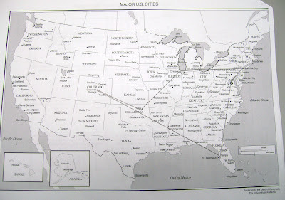
Each student chose 5 cities to travel to on their road trip. Using a ruler, they drew out their route on a US map. Then, using the map scale, students determined the length of their road trip in miles.
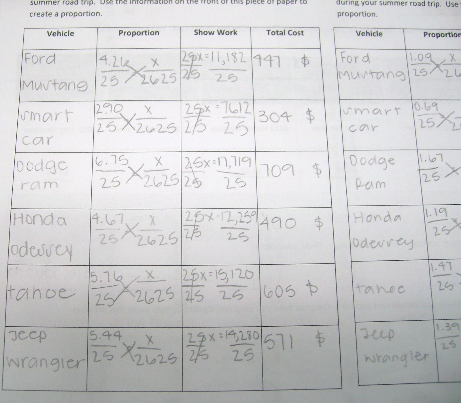
Day 2 of the road trip project was spent using gas mileage and fuel costs for various vehicles to determine which vehicle students would take on their road trip.
On Day 3, we calculated food costs, hotel costs, and rental car costs. By the end of the 3-day project, students were much, much, much more comfortable working with ratios and proportions.
It was an amazing experience to see the light bulbs go off with so many of my students.
Looking back at Day 2 and 3, there are a ton of little things I would change. I actually changed the rental car problem on Day 3 because my students were having a ton of trouble with it. I just did a flat rate per day.
This pre-algebra road trip project is easily adjusted based on your time limitations and the level of your students. This was never intended on being a 3-day project. It just sort of evolved into one.
My 8th graders really enjoyed it. My cooperating teacher enjoyed it. My University Supervisor even observed me on Day 3 of the project.
The lesson was a little more chaotic than I had planned, but my supervisor complimented me on the project. He even asked for electronic copies of the files to send to some math teachers in China.
Edited to Add : I have also done this with my Algebra 1 students.
Since I had already done this project with 8th graders, I thought my Algebra 1 students would be able to whiz right through it. I was wrong. I had to teach many of my students how to read a ruler.
Rounding to the nearest quarter inch was a disaster. And, the questions students asked me made me feel more like a geography teacher than a math teacher.
These are actual conversations I had with my Algebra 1 students during this activity.
Me: Class, today we are going on a road trip. If we’re going on a road trip, that means we will be traveling on… Class: Roads! Me: Yes, so that means we can’t travel to… Class: Hawaii Student 1: Why can’t you drive to Hawaii? Me: Hawaii is an island. That means it is surrounded by water. Student 2: Why does Hawaii look so weird? Custodian who just happens to be emptying the trash at this point: Hawaii is a series of small islands. Student 3: Do you mean you can’t drive between the little islands? Custodian: No. When I was in Hawaii, we traveled between the islands by taking ferries.
Student 1: Is Washington, D.C. here? [The student is pointing at Washington state.] Me: No. Student 2: No, Washington, D.C. is in Virginia.
Student 1: I think this map is wrong. Me: Why? Student 1: Oklahoma City should be above Tulsa.
Student 1: Do you mean Nashville, Tennessee is in the United States? Me: Yes. Nashville is in the U.S. Student 1: I’ve heard of it before, but I didn’t realize it was in the U.S.
I required my students to write both the city and the state they were visiting on their assignment. One student wrote that she was traveling to New Jersey, PA.
Free Download of Pre-Algebra Road Trip Project
Road Trip Project Day 1 (WORD) (4560 downloads )
Road Trip Project Day 2 (WORD) (3398 downloads )
Road Trip Project Day 3 (WORD) (2965 downloads )
Road Trip Project Map and Rubric (PDF) (3216 downloads )
Video with Instructions on Completing the Road Trip Project
I ran across a YouTube video that someone created to walk students through completing the Road Trip Project. I thought I would link it here in case it was of use to anybody.
More Activities for Teaching Ratios and Proportions
Wednesday 4th of September 2019
Any chance you have the CC standards that are associated with this project?
Monday 27th of May 2019
Great project!
Friday 25th of January 2019
FOR STEP FOUR OF DAY ONE DID YOU HAVE THE STUDENTS USE THE UNIT CONVERSION OF MILES TO INCHES AND THEN SET THAT EQUAL TO THEIR DISTANCE?
Tuesday 30th of October 2018
i think she used a lot of creativity to make this project.
Monday 20th of February 2017
what is the cost/gallon of the fuel? Where do you get it from?
Thursday 18th of May 2017
I'm was the one that needed help that says anonymous
And my email is eliasdaniel4599[at]gmail.com, thank you
Hello their Sarah I'm having trouble with this project if you could plzz send me the answers like all of it plzzz:( this is due Friday my grade is at a D right now just plzz I'm sorry for bugging like asap lol thank you
Sarah Carter (@mathequalslove)
Friday 3rd of March 2017
I got the fuel data for 25 miles from https://www.fueleconomy.gov/

- $ 0.00 0 items
Real World Math | The Algebra of Planning a Road Trip

When you plan a road trip, you use math literally every step of the way. What you may not know, however, is the right math term for what you’re calculating. So today, I’m going to walk you through a few steps of planning a road trip so you can see how Algebra helps you get from point A to point B successfully.
The first place you will encounter math when planning a road trip is by figuring out how far it is from where you want to start to where you want to go. For the sake of this example, we are going to plan a road trip from AskDrCallahan’s headquarters in Birmingham, Alabama all the way to Maine.

The first thing you’ll notice is how awesome the map looks. After that, though, pay attention to the three lines shown on the map. See how there are three different mapped out routes from Alabama to Maine?
And they all have different distances. Different distances means it takes longer to travel some of the routes than others.
But is that accurate?
Look again.

Notice some routes have extensive construction where other routes have far less. The number of times you stop along your chosen route, including construction zones, can make a shorter distance take longer to travel.
So how do you decide which one is right for you? Well, you have to use your logical thinking cap to consider which variables matter most to you, and you can apply a little Algebra .
In Algebra 1 you are taught a formula called The Distance Formula.
Distance = Rate (Time)
It allows you to calculate the distance, rate, and time of any given trip..
That means, if you plug in a slower rate for a longer trip, you might find that the longer route actually gets you there faster if it has less construction and allows you to go at a faster rate (speed).
A second place you will encounter Algebra 1 when planning a road trip is with your GPS.
Now, I know, you’re thinking—wait! GPS is a mapping service and it works by itself. I definitely will NOT need math when I’m using GPS.
Well, it turns out, when you take a long road trip there are things like wrecks, batteries that die, and just straight getting lost that can confuse both you and your onboard GPS to such a degree that you need to do your own recalculating.
Will you be able to get yourself to your desired destination if the GPS goes out? What will you do when the GPS isn’t aware of a road hazard that’s only been updated locally and therefore isn’t showing up on your GPS’s navigation system? Will you be able to take an alternate route?

The basics of using a good old fashioned paper map include two main math equations: Scale and Coordinates.
Scale is the idea that a large distance is represented by a small measurement. On a map, it might be shown as 1 cm = 10 miles. Therefore on your paper, the 1413 miles between Alabama and Maine would be a distance on paper of 141.1 cm. That allows you to hold an entire country in your hands (or in your car).
Coordinates on a map are written a lot like what you learn in Algebra 1 when you learn to graph on a coordinate plane. There are lines that run vertically, called Longitude lines and horizontal lines that are called Latitude. In Algebra 1 , you call these the x and y axes.
On a map, the equator is represented as 0 degrees and you count up and down from there to find different points on the globe.
Try it At Home
You can try your hand at reading a map by finding the country located at (0 degrees, 60 degrees West)
The west designation there is included to let you know to look in the western hemisphere. Give it a try. Did you find it? (Post your answer in the comments!)
Now there’s a massive amount of additional Algebra and Geometry you can practice when planning a road trip, but hopefully, this gives you a nice introduction to exactly how math helps make traveling a lot more fun, and a lot less dangerous! Just planning one road trip you will use the Algebra concepts of estimation, rounding, decimals, fractions, ratio, proportion, rational expressions, conversions, rates, and The Distance Formula. Not to mention the regular operations of additional, multiplication, division, and subtraction.
Math is a powerful tool that works behind the scenes on many of our everyday activities—like going on vacation, enabling us to do more and go further by knowing how to use it.
Can you go an entire day without math? No numbers, no measuring, and no calculating of any kind for a full 24 hours.
Can you do it report back to us in the comments., 1 thought on “ real world math | the algebra of planning a road trip ”.
Thanks, it’s quite informative
Comments are closed.
Register for free

Summer Road Trip Project
$ 5.00 Multi-licenses $ 4.50
- Resource Type
- Math Centers
sold by Math Teachers Lounge
View shop page
Item Details
Digital Download
INSTANT DOWNLOAD Files will be available for download from your account once payment is confirmed. Learn more . Please contact the seller about any problems with your order using the question button below the description.
Item description
Your students will use their knowledge of ratios, rates, proportions, and percents to help plan a summer road trip for “Debbie”. The project is broken up into the following tasks:
Task #1 : Calculate Total Miles Traveled
Math Skill Required: Scale Factors
Description: Students will use a map with a scale factor and a ruler to determine the total miles of the trip.
Task #2: Choose Car Rental
Math Skill Required: Unit rates and percentage discounts.
Description: Students will be given options for a car rental and need to calculate the cheapest option including what will be spent on gasoline. They will be given rates per day, as well as miles per gallon for each vehicle.
Task #3: Snack Shopping
Math Skill Required : Unit Rates
Description: Students will find unit rates to decide which snacks to purchase for the road trip.
Task #4: Hotel Costs
Math Skill Required: Sales tax and discounts.
Description: Students will figure out the cost for the hotel stays based on rates per night, sales tax and fees, and percent discounts.
Task #5: City Attractions
Math Skill Required: Proportions
Description: Students will set up proportions to solve problems about the attractions that Debbie will be visiting.
Task #6: Miscellaneous Expenses
Math Skill Required: Markups and Discounts
Description: As Debbie shops for last minute trip items, the students will help her calculate costs that involve markups and discounts.
From the same author
Systems of inequalities – “when will i ever use this”.
by Math Teachers Lounge
"When will I ever use this?" The famous question asked by every Algebra student. Give your students a REAL application of systems of inequalities with this mini project! When…
Algebra Taboo
Played just like the original TABOO game, this Algebra version gets kids reviewing their vocabulary terms in a fun and competitive way! In this fun edition, students try to get…
Geometry Basics- Points Lines and Planes: Stations
Geometry Basics Stations Activity is a fun way to review the basics learned in the first unit of high school geometry. Get students moving around the classroom reviewing the following…
Famous Scientists Posters
This file contains 21 posters of famous scientists to hang in your classroom! Each poster contains the scientists name, years he/she lived, what that person is best known for (including…
- Physical Science
- Decor & Displays
Polynomial Functions and Quadratics – “When Will I Ever Use This?”
"When will I ever use this?" The famous question asked by every Algebra student. Give your students a REAL application of polynomial functions with this mini project. When textbook application…
Geometry Word Wall: Shabby Chic
Create a gorgeous, shabby chic Geometry Word Wall! This file contains 52 pages, containing 62 terms and images (two sizes each), perfect for any geometry classroom. The following terms are…
trig ratio project
All Formats
Resource types, all resource types.
- Rating Count
- Price (Ascending)
- Price (Descending)
- Most Recent
Trig ratio project
Trigonometric Ratios Project

- Word Document File
Trigonometric Ratios word problems project

Geometry Social Justice Project using Trig Ratios

- Google Docs™
Geometry Road Trip - Project Based Learning PBL
Right Triangle Trigonometry Real World Geometry Brochure Project

High School Geometry Final Design Project

Unit Circle Project
Clinometer Project

Clinometer Trigonometry Rich Task | Engaging, Authentic, Project -Based-Learning

Common Core Geometry Project (G.SRT.6 & G.SRT.8 Trigonometry in the Real World)

Trigonometric Ratios and Solving Notes Sheet/Graphic Organizer FREEBIE!!!!
Black History Unit Circle Project

Trig Ratios to solve for Unknowns Paper Chain Activity

Trigonometric Ratios to solve for unknowns Scavenger Hunt Activity
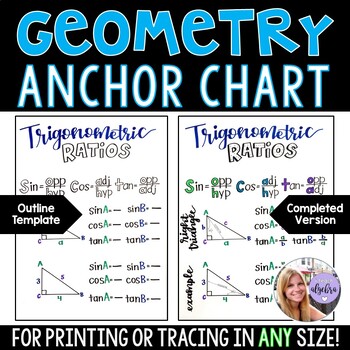
Geometry Anchor Chart - Trigonometric Ratios Sine, Cosine, Tangent Poster

Trig Ratios Matching Activity
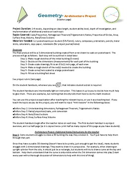
Geometry architecture project

Indirect Measurement ( Ratios , Proportions, Trigonometry )

Trig Ratios Riddle Activity
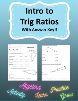
Intro to Trig Ratios
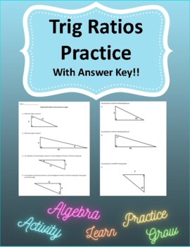
Trig Ratios Basics
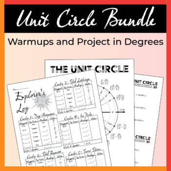
Unit Circle Warmups and Project in Degrees Bundle

Right Triangle Trigonometry ( Trig Ratios ) Geometry SmartBoard Lessons

- NOTEBOOK (SMARTboard) File
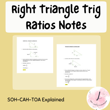
Right Triangle Trig Ratios - Explanation Guide (SohCahToa)

- We're hiring
- Help & FAQ
- Privacy policy
- Student privacy
- Terms of service
- Tell us what you think

IMAGES
VIDEO
COMMENTS
This project is on Distance and Midpoint Formulas.
Description. Follow along with Jacob and his family on their summer road trip! This project is a great end-of-the-year activity for your high school geometry students, as it reviews many topics that are taught throughout the year. It can also be broken up into the individuals tasks, to give as an end of unit assessment activity for each topic.
In this project students are enabled to:1- Find the coordinated plane from the given graph.2- Use the distance formula to find the distance between two point...
Geometry Road Trip Project Geometry Made Simple Kathleen Eernisse 2001-09-11 Now it's simple to make Algebra and Geometry fun and exciting. Includes background information, extension activities, group learning, school-home connections, and student activities for a variety of teaching units. An easy-to-use teacher resource that makes learning fun!
Decrease Quantity of Geometry Road Trip - Project Based Learning PBL Increase Quantity of Geometry Road Trip - Project Based Learning PBL. Add to Cart later Add to Wish List. Create New Wish List; Description; Description. Follow along with Jacob and his family on their summer road trip! This project is a great end-of-the-year activity for your ...
Road Trip Math: I love using this road trip math project at the end of the year or the beginning of the year as we talk about summer break. This one also has FREE road sign math task cards that work well with it. It covers SO MANY math skills like problem solving, place value, money, etc.
Math Road Trip Richard G. Cote 2013-06-06 In Math Road Trip, students learn about the concepts of addition, subtraction, multiplication, and division of fractions and decimals, explore ratio and proportion, and investigate scale drawing and rate problems as they plan the ultimate vacation for their families.
Item description. Follow along with Jacob and his family on their summer road trip! This project is a great end-of-the-year activity for your high school geometry students, as it reviews many topics that are taught throughout the year. It can also be broken up into the individuals tasks, to give as an end of unit assessment activity for each topic.
Math Teachers Lounge
View shop. Follow along with Jacob and his family on their summer road trip! This project is a great end-of-the-year activity for your high school geometry students, as it reviews many topics that are taught throughout the year. It can also be broken up into the individuals tasks, to give as an end of unit assessment activity for each topic.
Browse road trip project coordinate geometry resources on Teachers Pay Teachers, a marketplace trusted by millions of teachers for original educational resources.
To develop the attitudes, skills, and knowledge of a geographer while exploring their own world, each year my students undertake a semester-long project to create a road trip to a select part of the world based on their grade level. The project combines math, English language arts, science, and social studies.
Day 2 of the road trip project was spent using gas mileage and fuel costs for various vehicles to determine which vehicle students would take on their road trip. On Day 3, we calculated food costs, hotel costs, and rental car costs. By the end of the 3-day project, students were much, much, much more comfortable working with ratios and proportions.
This project combines a review of the coordinate plane, distance, midpoint, and geography. This project is 3 pages. The first is the map on a coordinate plane. The second and third are guided instructions where students will identify their stops, distance, midpoint, etc. This requires no prep. Just print and assign. Total Pages. 3 pages.
Geometry Road Trip Project Jacob and his family are about to leave on their summer road trip! At each stop along the way, we find that there are certain geometry skills that are essential to the success of the trip! Follow along with Jacob's family to help solve the problems that arise... Skills that are needed: STOP 1: THE BEACH Volume of cones, pyramids, and cylinders.
Just planning one road trip you will use the Algebra concepts of estimation, rounding, decimals, fractions, ratio, proportion, rational expressions, conversions, rates, and The Distance Formula. Not to mention the regular operations of additional, multiplication, division, and subtraction. Math is a powerful tool that works behind the scenes on ...
Road Trip Project Block _____ This summer, your family of four people has decided to take a road trip! You will start in Ashburn and travel to five other U.S. cities, all outside the state of Virginia, before returning home to Ashburn. You will obviously need Algebra in order to have fun! Step 1: Plan your trip. You can visit any city in the ...
Your students will use their knowledge of ratios, rates, proportions, and percents to help plan a summer road trip for "Debbie". The project is broken up into the following tasks: Task #1 : Calculate Total Miles Traveled. Math Skill Required: Scale Factors. Description: Students will use a map with a scale factor and a ruler to determine ...
Road Trip Math Project Math on the Move Katie Marsico 2014-10-01 Math is everywhere when you're traveling! See who's on the move inside this book—and how we need ... Amelia Bedelia Road Trip!: #3 Herman Parish 2021-12-15 Tripping over roads may not be your idea of fun, but for Amelia Bedelia a road trip is a true adventure. Aligned to Common ...
This Plan Your Dream Road Trip is an engaging PBL project for your students to dive into real world Math application while practicing Math, Geography, and problem solving skills. Students will plan their road trip from start to finish in a 9 part process that includes their travel plans, mapping it out, creating an itinerary and calculating expenses, building their model, and practicing 3 6th ...
Road Trip Math Project Answer Key - Splitforyou.com. Possible answer: 6 1 8 5 14 and 18 2 14 5 4, so there are 4 bull shark teeth and a total of 18 shark teeth. Each answer shows how to solve a textbook problem, one step at a time. is a dynamic curriculum and proven instructional path built upon a foundation of critical thinking.
This Learning & School item is sold by MathTeachersLounge. Ships from United States. Listed on Jan 6, 2024
Geometry Road Trip - Project Based Learning PBL. Created by . Math Teachers Lounge. Follow along with Jacob and his family on their summer road trip! This project is a great end-of-the-year activity for your high school geometry students, as it reviews many topics that are taught throughout the year. It can also be broken up into the ...